
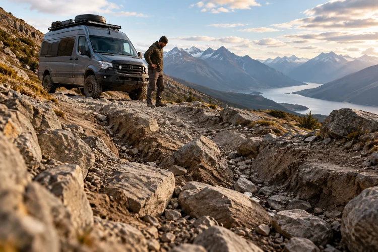
Picture yourself driving an adventure van along a remote mountain trail. The scenery is incredible, the weather looks perfect, and your navigation app promises an unforgettable destination.
Then, around the next bend, the road turns into a steep, rocky track with deep ruts and almost nowhere to turn around. Suddenly, that exciting shortcut feels like a serious problem.
Long-distance overland travel isn’t just about finding scenic routes. It’s about understanding whether those routes are suitable for your vehicle, driving experience, equipment, and current environmental conditions.
That’s why evaluating terrain risk for long-distance adventure van routes should be an essential part of every expedition plan.
A road that appears manageable on a digital map might contain loose gravel, unstable slopes, muddy crossings, or damaged bridges. Weather can transform relatively easy trails into dangerous obstacles within hours.
The good news is that you don’t need to be a professional expedition driver to make better decisions.
With practical terrain assessment techniques, reliable mapping tools, and realistic vehicle preparation, you can reduce unnecessary risks while still enjoying the freedom of remote exploration.
1. Understand the Different Types of Terrain Risk
Recognize that every surface behaves differently
Not all unpaved roads present the same challenges.
A smooth gravel road might be straightforward for a properly equipped campervan, while a rocky trail of the same distance could require considerably more ground clearance, traction, and driving skill.
Loose sand creates another set of problems because tires can sink and lose forward momentum. Mud can reduce traction dramatically, particularly when the surface contains clay or becomes saturated after rainfall.
Rocky terrain introduces risks involving tire sidewalls, suspension components, and vulnerable underbody equipment.
Understanding these differences helps you decide whether a route is appropriate before reaching the most difficult section.
Distinguish manageable obstacles from serious hazards
A manageable obstacle is one your vehicle and driver can reasonably negotiate with an acceptable margin for error.
For example, shallow ruts on a dry forest road may simply require slower speeds and careful wheel placement. However, deep erosion channels beside a steep drop-off could create unacceptable consequences if traction is lost.
The distinction becomes especially important when driving a heavily loaded adventure van.
Unlike smaller off-road vehicles, campervans often have longer wheelbases, greater overall height, and additional weight from water tanks, cabinetry, batteries, and camping equipment.
These characteristics can reduce maneuverability on narrow tracks.
Consider the consequences of getting stuck
Terrain difficulty is only one part of expedition risk.
A minor mechanical problem near a populated town is inconvenient. The same problem hundreds of kilometers from reliable communication and recovery services can become an emergency.
Always consider the likelihood of something going wrong and how serious the consequences could be.
This broader perspective turns route selection into a practical safety decision rather than a simple test of driving confidence.
2. Use Maps and Digital Tools to Evaluate Routes Before Departure
Read topographic maps carefully
Topographic maps are incredibly useful for understanding the physical landscape surrounding an expedition route.
Unlike ordinary road maps, they display elevation information, contour lines, valleys, ridges, and other terrain features.
Closely spaced contour lines generally indicate steep slopes, while wider spacing suggests gentler terrain.
For example, imagine a route climbing 300 meters over three kilometers of horizontal distance. Its average gradient would be approximately 10%.
However, that doesn’t mean every section has the same gradient. Individual segments might be substantially steeper than the overall average.
This is why examining the route’s elevation profile alongside detailed terrain imagery is so valuable.
The USGS National Map provides authoritative topographic information for the United States and illustrates how elevation data can support navigation planning.
Combine satellite imagery with road information
Satellite imagery can help identify exposed ridgelines, narrow mountain roads, river crossings, and major changes in surrounding vegetation.
It may also reveal hairpin turns or road sections that appear unusually steep.
However, satellite images have limitations.
They may be outdated, obscured by trees, or captured before recent flooding and erosion.
A road that looks perfectly maintained in aerial photography might now contain severe washouts.
Use satellite imagery as one source of information rather than treating it as proof of current conditions.
Verify legal access and seasonal restrictions
A visible road isn’t necessarily open to public vehicles.
Protected areas, forestry routes, private property, and seasonal wildlife closures may restrict access.
In the United States, the Forest Service publishes Motor Vehicle Use Maps showing designated motorized routes and relevant seasonal restrictions.
Other countries have different land-access rules and official mapping systems.
Before entering remote territory, confirm route legality, permits, and current closures through the responsible land-management authority.
3. Match Terrain Difficulty With Your Adventure Van’s Capabilities
Evaluate ground clearance and wheelbase
Your campervan’s physical dimensions strongly influence the terrain it can safely handle.
Ground clearance determines how much room exists between the vehicle’s lowest vulnerable components and obstacles on the trail.
However, clearance alone doesn’t tell the whole story.
A long-wheelbase vehicle can become high-centered when crossing sharp ridges, even if its tires and suspension are otherwise suitable.
Approach and departure angles also matter when entering steep dips or climbing out of erosion channels.
A long rear overhang may strike the ground before the rear wheels reach an obstacle.
The National Park Service’s Joshua Tree backcountry road guidance describes routes containing deep sand, loose rock, and narrow sections that can prevent larger vehicles from passing.
Understand the role of traction and drivetrain systems
A four-wheel-drive system can improve traction under certain conditions, but it doesn’t eliminate terrain risks.
All-wheel drive and four-wheel drive vary substantially between vehicle models.
Some routes require high clearance, low-range gearing, and specialized off-road equipment. A standard adventure van with road-oriented tires may not be suitable, even if it drives all four wheels.
Tire condition, load rating, tread design, and inflation pressure also influence performance.
Adjusting tire pressure for rough-road driving should follow vehicle and tire manufacturer guidance, with appropriate reinflation before returning to normal road speeds.
Account for vehicle weight
A fully loaded expedition van behaves differently from an empty vehicle.
Additional weight affects braking, acceleration, suspension movement, tire loading, and traction on soft surfaces.
For example, carrying 100 liters of water adds roughly 100 kilograms before considering the tank and fittings.
Add passengers, recovery equipment, tools, and food, and the total increases quickly.
Always respect the vehicle’s gross weight and axle ratings, and remember that suspension upgrades don’t automatically increase those legal limits.
A realistic capability assessment is neccessary before committing to technical off-road routes.
4. Analyze Weather, Seasonal Changes, and Environmental Hazards
Understand how rain transforms terrain
Weather is one of the biggest variables in remote route planning.
A dry dirt road that provides excellent traction in the morning can become slippery and difficult to navigate after a heavy downpour.
Clay-rich surfaces are particularly troublesome because they can become extremely slick when wet.
Heavy rainfall may also create deep ruts, weaken road shoulders, or wash away sections of the track.
The U.S. National Weather Service warns that floodwater can hide damaged road surfaces and potentially sweep vehicles away.
Never drive into a flooded road or attempt a water crossing when conditions are uncertain.
Turning around is considerably safer than guessing the depth, current, or condition of the roadbed.
Consider snow, ice, and high-altitude conditions
Mountain expeditions introduce additional seasonal challenges.
Snow can hide rocks, drainage channels, and dangerous roadside edges. Ice can reduce traction even when a route appears relatively smooth.
Higher elevations may also experience sudden temperature changes, limited visibility, and stronger winds.
A mountain pass that’s accessible in summer may become impassable during winter.
Check local forecasts, snow conditions, official road reports, and seasonal restrictions before attempting elevated terrain.
Identify landslide and wildfire-related hazards
Steep slopes can become unstable after prolonged rainfall.
Rockfalls and debris flows may threaten roads beneath exposed cliffs, particularly where vegetation has been removed.
Recently burned landscapes deserve extra caution.
According to the USGS postfire debris-flow guidance, wildfire can alter drainage conditions, allowing intense rainfall to trigger dangerous flows of mud, water, and rock.
These hazards may affect areas downstream from the original fire.
When warnings or road closures are issued, choose another route rather than attempting to evaluate an active hazard from inside the vehicle.
5. Evaluate Remoteness, Recovery Access, and Expedition Logistics
Distance matters less than actual accessibility
A trail located only 40 kilometers from the nearest town might appear relatively safe.
But if those kilometers involve narrow rock passages, steep climbs, and poor communications, reaching assistance could take much longer than expected.
This is why route difficulty should influence travel-time calculations.
Imagine planning to cover 60 kilometers of rough terrain in one day.
At an average moving speed of 15 kilometers per hour, driving alone takes approximately four hours.
However, navigation stops, inspections, obstacles, and unexpected delays might significantly extend that schedule.
Build time buffers into each travel day and avoid depending on arriving at a critical junction just before darkness.
Calculate fuel and supply requirements
Fuel consumption often increases when traveling over rough terrain.
Low-speed technical driving, repeated acceleration, steep climbs, and extended idling can reduce range compared with ordinary highway travel.
Use conservative consumption estimates based on your actual vehicle and previous trips.
Carry enough food, drinking water, and essential supplies for unexpected delays.
The National Park Service’s Death Valley backcountry guidance emphasizes additional water, emergency equipment, spare tires, and preparation for delayed rescue.
The exact supply requirements depend on climate, route duration, passenger needs, and available assistance.
Prepare for communication problems
Remote expeditions frequently pass through areas without reliable cellular coverage.
Download offline navigation data before departure, including alternative routes and emergency exit points.
Carry physical maps where practical, and consider a suitable satellite communication device for isolated journeys.
Share your itinerary, expected check-in times, and contingency plans with a trusted contact.
If you become stranded, you should know how to request assistance and conserve essential supplies.
Being able to recieve help quickly isn’t guaranteed, so preparation matters before anything goes wrong.
6. Create a Practical Terrain Risk Assessment System
Build a simple scoring framework
You don’t need complicated engineering software to organize your route decisions.
A basic risk assessment can consider terrain difficulty, weather exposure, vehicle capability, and remoteness.
One practical method is to rate the likelihood of a problem and the seriousness of its consequences on a scale from one to three.
Multiplying those values provides a simple comparison score.
For example, a dry gravel road with minor potholes might receive a likelihood rating of one and a consequence rating of two, producing a score of two.
A narrow, eroded track beside a steep drop-off might receive three for both factors, producing a score of nine.
These numbers are illustrative planning tools, not scientifically validated safety ratings.
They should never override road closures, vehicle limitations, weather warnings, or an experienced driver’s judgment.
Compare route alternatives
Imagine choosing between two routes through a mountain region.
Route A is 110 kilometers long, with maintained gravel roads, moderate climbs, and several potential exit points.
Route B is only 70 kilometers, but includes steep switchbacks, loose rocks, and a remote river valley.
Although Route B appears shorter, it may involve greater mechanical stress, slower progress, and fewer opportunities to recover from problems.
Compare both routes using the same assessment criteria.
Consider available fuel, weather forecasts, vehicle dimensions, driver experience, and the likelihood of needing outside assistance.
The best overland route isn’t necessarily the shortest or most dramatic.
It’s the one offering an enjoyable journey with risks you can reasonably manage.
Establish clear go-or-no-go criteria
Before traveling, decide what circumstances would trigger a route change.
Examples include official closures, flood warnings, terrain exceeding vehicle clearance, insufficient fuel reserves, or weather conditions that make safe travel uncertain.
Also establish a latest acceptable turnaround time.
If progress is slower than expected, returning to a known safe location can prevent an avoidable overnight emergency.
Having these decisions in place reduces pressure to continue simply because you’ve already invested time reaching the trail.
7. Reassess Terrain Continuously During the Expedition
Watch for changes that maps cannot predict
Even excellent preparation cannot reveal every obstacle.
Unexpected washouts, fallen trees, loose rocks, and damaged drainage crossings can appear after storms.
Pay attention to changes in road texture, visible erosion, and deteriorating traction.
When conditions become uncertain, stop in a safe location and reassess.
If a route requires technical driving beyond your experience, don’t attempt it just because another vehicle previously passed.
Every vehicle has different dimensions, weight distribution, and recovery limitations.
Know when to inspect an obstacle
Some obstacles are difficult to evaluate from the driver’s seat.
When it is safe to stop and exit, an inspection from stable ground may reveal rut depth, hidden rocks, available clearance, or a lack of suitable turning space.
Avoid approaching unstable slopes, floodwater, or dangerous drop-offs on foot.
If a companion helps with vehicle guidance, establish clear communication and keep them outside the vehicle’s potential travel path.
Never place someone downhill from a vehicle where sliding or rollover is possible.
If the obstacle cannot be assessed or negotiated confidently, retreat to a safer route.
Prepare equipment without relying on it excessively
Useful expedition equipment may include a properly rated spare tire, compressor, shovel, traction boards, recovery equipment, and basic repair tools.
However, carrying these items doesn’t guarantee a safe recovery.
Improper towing, winching, or lifting techniques can cause serious injuries and vehicle damage.
Learn appropriate recovery procedures from qualified instructors and use only equipment compatible with your vehicle.
Regular vehicle maintainance is equally important, especially after prolonged travel over corrugated roads.
Inspect tires, suspension components, underbody protection, and accessible fasteners when conditions permit.
Respect the environment and established routes
Responsible terrain evaluation also includes understanding environmental impacts.
Driving around muddy sections can widen tracks and damage surrounding vegetation.
Creating unauthorized bypasses around obstacles may harm fragile ecosystems and violate land-management rules.
Stay on designated routes, respect closure signs, and avoid damaging road surfaces through unnecessary wheelspin.
Sometimes the responsible choice is simply to turn around.
Long-distance adventure travel is about exploring incredible places while helping preserve them for future visitors.
Evaluating terrain risk for long-distance adventure van routes is an essential skill for anyone exploring remote landscapes.
By combining topographic mapping, weather analysis, vehicle capability assessments, and realistic expedition planning, travelers can make better decisions before encountering dangerous conditions.
Understanding different road surfaces, carrying suitable equipment, and preparing for communication failures can also reduce the consequences of unexpected problems.
Most importantly, terrain evaluation shouldn’t stop once the journey begins.
Stay alert to changing conditions, respect your vehicle’s limitations, and be willing to turn around when necessary.
Before your next expedition, review your intended route, identify potential hazards, and establish practical backup plans.
With careful preparation and a flexible mindset, you can enjoy challenging adventures while making safety a priority on every kilometer.
